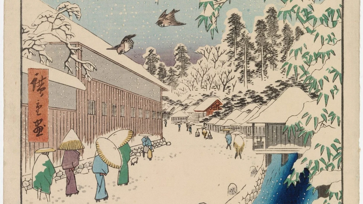

Udhëtim nëpër Kosovë në vitet 1836-1838
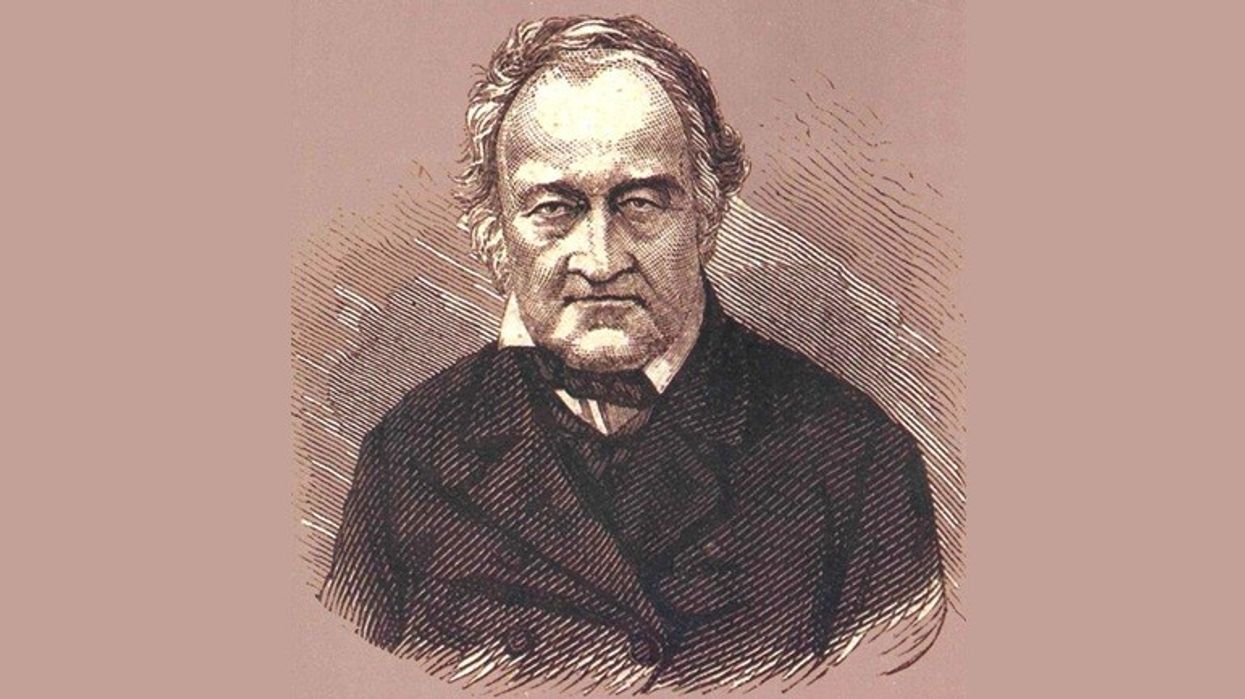
Gjeografi gjermano-austriak, Ami Boué (1794-1881), kishte origjinë nga një familje hugenote nga Berzheraku në Dordonjë (Francë) që ishte shpërngulur në Hamburg në vitin 1705. Ai lindi në Hamburg dhe ndoqi shkollën atje dhe në Gjenevë. Boué studioi për mjekësi në Edinburg, midis viteve 1814-1817, por u orientua gjithnjë e më shumë drejt gjeologjisë dhe botanikës. Pas përfundimit të studimeve në mjekësi, ai jetoi kryesisht në Paris, ku ishte një nga themeluesit (1830) dhe më vonë president (1835) i Shoqatës Gjeologjike Franceze [Société Géologique de France]. Pasi përfitoi një trashëgimi të konsiderueshme nga prindërit, ai udhëtoi nëpër Evropë, kryesisht në Gjermani, Austri dhe Ballkan. Në vitin 1841 u vendos në Vjenë ku u bë shtetas austriak dhe anëtar i Akademisë së Shkencave (1848). Udhëtimet dhe kërkimet e bëra nga Ami Boué në Turqinë Evropiane, një rajon që në atë kohë njihej pak, patën ndikim të thellë te brezat pasues të dijetarëve në të gjithë Evropën. Veçanërisht mund të përmendet vepra e tij monumentale në katër vëllime, La Turquie d’Europe ou observations sur la géographie, la géologie, l’histoire naturelle, la statistique, les moeurs, les coutumes, l’archéologie, l’agriculture, l’industrie, le commerce, les gouvernements divers, le clergé, l’histoire et l’état politique de cet empire [Turqia në Evropë, ose vëzhgime mbi gjeografinë, gjeologjinë, historinë natyrore, statistikat, adetet dhe zakonet, arkeologjinë, bujqësinë, industrinë, tregtinë, qeveritë e ndryshme, klerin, dhe historinë e gjendjen politike të kësaj perandorie], Paris 1840; si dhe vepra në dy vëllime Recueil d’itinéraire dans la Turquie d’Europe: détails géographiques, topographiques et statistiques sur cet empire [Itinerarë në Turqinë evropiane: detaje gjeografike, topografike dhe statistike mbi këtë perandori), Vjenë 1854. Vepra e fundit, nga ku janë marrë ekstraktet e mëposhtme, përfshin itinerarët e udhëtimeve të tij nëpër Kosovë në vitet 1836-1838.[1]
Nga: Ami Boué
Përktheu (nga frëngjishtja) në anglisht: Robert Elsie
Përktheu (nga anglishtja) në shqip: Agron Shala
Peja
Ipek (sllavisht Pecha, shqip Peja), që ndodhet 17 orë nga Novipazar-i [Novi Pazar], ka një vendndodhje shumë të këndshme dhe është e mbrojtur në Veri nga një perde gjigante malore. Duke dalë nga gryka e thellë e Streta Gora-s, lumi Bistritza [Bistrica] kalon përmes qytetit ndërmjet maleve Peklen (po ashtu shqiptohet Paklen) dhe Koprivnik për rreth gjysmë lige [4.83 kilometra - shën. i T.]. Ujërat e tij të rrëmbyeshëm shërbejnë për të vënë në punë mullinjtë dhe për të larguar mbeturinat. Disa rrugë përmbyten nga degët e kësaj rrëkeje dhe trotuaret e ngushta këtu shërbejnë si ura. Për më tepër, kjo rezidencë e lashtë e patriarkëve serbë duket qartësisht në rënie, sepse nuk ka më shumë se 2 000 shtëpi ose 7 000 deri në 8 000 banorë, shumica e të cilëve duken të jenë serbë të fesë greke [ortodokse]. Këto të dhëna të mbledhura në vend ndryshojnë nga ato që dha Dr. Müller, i cili përmend 2 400 shtëpi dhe e rrit numrin e banorëve në 12 000, duke pohuar se shumica e tyre janë myslimanë dhe se nuk ka më shumë se 130 familje të fesë greke dhe 20 familje të fesë katolike romane. Megjithatë, ai vëren se sllavët përbëjnë shumicën kombëtare, gjë që bën të dyshohet se shumë prej tyre thjesht pretendonin të ishin myslimanë për t’u trajtuar më mirë. Sipas tij, ka vetëm 62 familje turke, 100 familje shqiptare dhe 28 familje zinzarësh [vllahë]. Nëse popullsia myslimane do të kishte qenë shumicë, do të ishte e vështirë të shpjegohej numri i paktë e xhamive. Ne pamë vetëm tri, një prej të cilave në Verilindje, një pranë tregut dhe një tjetër pranë daljes nga qyteti në Jugperëndim, në rrugën për në Detschiani [Deçan]. Në dëshirën e tij dhe sipas zakonit të sllavëve për të ekzagjeruar numrat e tyre, murgu Jurišić i jep Ipek-ut 4 000 shtëpi, prej të cilave 700 deri në 800 janë serbe dhe të fesë greke. Dyqanet, sipas Dr. Müllerit, mbi 960 (?), gjenden të gjitha në katër rrugë që përbëjnë tregun. Rrugët dhe shtëpitë hijesohen herë pas here nga hardhitë në shtylla. Ka dy ose tri hane, prej të cilave ai pranë hyrjes së qytetit në anën e Djakova-s [Gjakovës] është më i miri, sepse ka disa dhoma të pastra në katin e sipërm.
Lexo po ashtu:
– Udhëtimi i vitit 1858 në Shqipërinë dardane – Një udhëtim përmes Shkupit dhe Kosovës (1669) – Kosova në Luftën e Madhe Turke të viteve 1683-1699 – Një udhëtim nga Prizreni në Shkodër më 1839
Në Veriperëndim, një çerek ore nga qyteti ndodhet manastiri serb i Shën Arsenit, rezidenca e lashtë e patriarkut serb që është shndërruar në kazermë. Është e vendosur mbi një grykë të vogël që zotëron qytetin dhe është i rrethuar me mure të trasha dhe hendekë. Ndërtesa, në fakt, përmbante tri kisha nën një çati, një të madhe dhe dy të vogla. Njëra prej tyre është Kisha e Zonjës së Madhe dhe një tjetër është Kisha e Shën Dhimitër Martirit. Ka tri kupola dhe është e mbuluar me plumb. Në hyrje të kishës ndodhen tri kolona prej guri dhe dy prej mermeri të bardhë. Konaku i pashës, me dy krahë, ndodhet në skajin më veriperëndimor të qytetit, në Pehlivan Meidan. Është një ndërtesë prej guri me një kat të sipërm, e rrethuar me mure dhe me një portë të madhe. Përballë saj ka një lulishte me disa pemë dhe një xhami, të cilës i është bashkangjitur një shkollë ose medrese. Pasha gjithashtu ka një shtëpi fshati, ose një për haremin e tij të vendosur në hyrje të Streta Gora-s dhe një tjetër pranë Novo Selo-s.
Pashallëku i Ipek-ut, dikur një administrim gjysmë-i trashëguar, është thjesht pjesë e Doukadgin-it [Dukagjinit], dhe përfshin kazatë e Ipek-ut, Djakova-s, Has-it ose Hass-it [Has] dhe Kéroub-it (?). Ai mbulon kryesisht pjesën veriore të Metochiia-s [Metohisë] dhe një pjesë të maleve në Verilindje, ku ka vetëm fshatra dhe katunde. Dr. Müller i jep atij një popullsi prej 65 000 banorësh, nga të cilët 31 000, sipas tij, janë të krishterë të ritit grek.
Pasha Abdularasa flet serbisht dhe turqisht dhe rrjedh nga familja Brenović e Bosnjës. Ai na pranoi me mirësjellje. Apartamentet e tij dukeshin shumë më mirë se ato të pashës së Novipazar-it. Ai dha urdhër që ne të strehoheshim te një qytetar i pasur i qytetit që zotëronte dy shtëpi. Kështu, u detyruam të linim hanin tonë serb. Kavasi i pashës trokiti në disa dyer dhe të parët që i hapën u detyruan të ndihmonin në bartjen e bagazheve tona. Patëm rastin të vizitonim nipin e pashës, një djalë i sëmurë që vuante nga hidrocefalia dhe që ishte mbështjellë në një lloj kanapeje me një tendë të madhe, të rëndë, të qëndisur me ar.
U ngjitëm në majën e Malit Peklen, që është maja më e afërt me qytetin. Rruga që të çon atje ishte ajo e Rugovës, një fshat me 1 200 shqiptarë myslimanë të fisit Klementi [Kelmendi], të cilët, pak kohë më parë, kishin qenë katolikë. Ai ndodhet gjashtë ose shtatë orë larg Ipek-ut, përtej një shkrepi të Malit Haila ose Hailasi [Hajla] (fjala shqipe është haliki, që do të thotë shkëmbor), rrëzë Schtedim-it [Shtedim]. Prej andej mund të vazhdohet deri te lumi Lim dhe te pellgu i Plava-s [Plavë] përmes një lugine të thellë të vendosur midis qytetit tregtar të Plava-s dhe luginës së Velika-s. Ka gjithashtu një fshat të quajtur Trebigne [Trebinje]. Ky itinerar përdoret shumë gjatë verës nga fshatarët dhe kuajt e tyre ngarkues të cilët vijnë e shkojnë midis Bosnjës jugore dhe pellgut të lartë të Shqipërisë së Epërme. Megjithëse veshja e tyre ishte e kufizuar vetëm në atë që ishte rreptësisht e domosdoshme dhe disa prej tyre ecnin zbathur ndërsa qylafët e tyre të kuq ishin shumë të vjetër, fytyrat e çiltra të këtyre qenieve - që për një të huaj duken të egra - ngjanin me ato të malësorëve zviceranë. [...]
Deçani
Bëmë një vizitë në manastirin e famshëm serb të Deçanit që ndodhet dy ligë e gjysmë në jugperëndim të Ipek-ut. Udhëheqësi i të krishterëve të Ipek-ut na dha një nga njerëzit e tij si udhërrëfyes dhe e lamë tartarin tonë në shtëpi. Duke dalë nga qyteti, kaluam pranë një xhamie ku një klerik ishte duke u falur. Ai bëri një shenjë sikur donte të na largonte ose që prania jonë po e ofendonte atë. Në kthim, disa djem të këqij na hodhën mollë, një shenjë se fanatizmi fetar nuk është kapërcyer tërësisht në këto rajone të largëta të Turqisë.
Rruga nga Ipek-u për në Detschiani ose Detschani ndjek këmbët e maleve, për rreth një çerek lige prej tyre, dhe kalon nëpër tri fshatra shqiptare të quajtura Striatz [Strellc] (Kiepert e quan Striotza), Lioubouscha [Lëbusha] me rrënojat e Kishës së Shën Ilisë, dhe Lioubonitch [Lybeniq]. Na u tha se fshati i dytë, afërsisht në mes të rrugës, ishte vendi ku 23 ushtarë të pashës u vranë nga banorët vitin e kaluar (1835). Siç shihet, shqiptarët e urrejnë administratën turke. Megjithatë, gratë shqiptare, të cilave guxuam t’u thoshim mirëmëngjesi gjatë kalimit, u përgjigjën me mirësjellje, ndryshe nga zakoni oriental. Rrethinat e manastirit dhe madje edhe hyrja e luginës së Detschani-t janë të fshehura nga një pyll i madh gështenjash, Gora Koschtanova (Kestenova). Fshati shqiptar i Detschani-t ndodhet gjysmë ore në Lindje të manastirit mbi Bistritza. Rruga më e shpejtë për në manastir është që të kalohet një kreshtë e vogël pyjore, nga e cila të befason panorama e një lugine të vogël, të bukur dhe të gjelbëruar ku kisha dhe manastiri i Detschiani-t janë fshehur në anën jugore të një kodre të mbuluar me lisa, rrëzë një mali shkëmbor të quajtur Pliesch. Më në Jug gjenden malet e mbuluara me pisha me kreshta të ulëta që mbajnë emrin Detschiani. Bagëtia e manastirit kullot aty në verë, një çerek ore larg. Për të arritur te porta e rrethimit të manastirit, duhet kaluar lumi Detschianska Bistritza [Lumëbardhi i Deçanit], i cili rrjedh nga Veriperëndimi në Juglindje dhe ka një shtrat me shumë gurë. Manastiri përbëhet thjesht nga një ndërtesë me një kat të sipërm që ka pamje shumë të hollë. Megjithatë, kisha e bukur prej mermeri është një monument që mund të gjendej lehtësisht në secilin nga qytetet tona. Ka gjithashtu dy kisha më të vogla, një kushtuar Shën Nikollës dhe një tjetër Shën Dhimitër Martirit.
Në manastir ishin vetëm pesë ose gjashtë murgj. Igumeni ishte i paralizuar dhe kishte kohë të gjatë që rrinte në shtrat. Ai ankohej për borxhet e manastirit të shkaktuara nga kërkesat e vazhdueshme turke. Ky mendim e shqetësonte tmerrësisht, siç thoshte ai, sepse besimtarët mund të pushonin së paguari interesat dhe të rimbursonin shumën e huazuar. Ky murgu i varfër vdiq atë vit dhe më 1837 ishte një abat i ri të cilin e takuam atje. Brenda manastirit ka një kopsht të vogël perimesh dhe jashtë pronës ka kryesisht ara, kullota dhe pyje të mëdha.
Në Perëndim të manastirit ndodhet një djerrinë me pyje dhe male gati dhjetë liga në gjatësi, përmes së cilës mund të arrihet në luginat e larta të Prokletija-s [Alpet shqiptare - shënim i T.] dhe madje të Shalia-s [Shala] dhe Gouzinie [Gucia]. [...]
Nga Peja në Prishtinë
Rruga nga Ipek-u për në Prischtina [Prishtinë] kalon nëpër fushën që shtrihet nga Perëndim-Veriperëndim në Lindje-Juglindje. Ajo është e kultivuar herë pas here, por kryesisht e mbuluar me kullota dhe grupe pemësh. Në të djathtë dhe përballë nesh ishin kodrat e quajtura Kraljania (e mbretit). Një ligë larg Ipek-ut kaluam me radhë Plavian-in [Pavlan], Zachatschi-n [Zahaç] dhe Labian-in ose Lebian-in [Llabjan]. Ky mund të jetë vendbanimi të cilit i referohet Dr. Müller si Lebous. Ai gjithashtu përmend një fshat mysliman në jug të Ipek-ut me emrin e çuditshëm Voksch [Voksh] (20 orë), dhe tri liga më tej është Tzrkva [Svërka] (kishë). Një grua e vjetër serbe e varfër u ankua teksa na ofroi pak ujë: “Më në fund erdhët! Të krishterët këtu po presin Princ Milloshin si Mesinë e tyre, për të na çliruar nga vuajtjet tona”! Duke na parë të rrethuar nga serbë, ajo mendoj se ishim një nga ata. Në vend që të reagonte me zemërim, kavasi i Ipek-ut thjesht u përgjigj: “Gruaja e vjetër është e marrë”! Ky vend ndoshta është një vend mjaft i pakëndshëm për shërbëtorët e pashallarëve, sepse udhërrëfyesi ynë mori me vete dy palë pistoleta dhe një pushkë. Në Jug të Doubaschar-it, disa kodra të vogla dhe pyje lisi e çojnë udhëtarin në Novoselo dhe më pas te lumi Drim [Drin], që kalohet mbi një urë druri. Drsnik-u [Dërsnik], gjashtë orë nga Ipek-u, ndodhet në bregun e kundërt, rrëzë disa tarracave të vogla.
Për të shkuar prej andej në Prischtina, kalon nëpër terrene pyjore dhe shkëmbore në Perëndim të Drsnik-ut, i pari prej të cilëve quhet Drsnikbari dhe i dyti Brtschevabari. Copat e gurit gëlqerori eocen shfrytëzohen këtu për mbulimin e çative të shtëpive në rrethinë. Dy liga nga Drsnik-t arritëm në Iglareva [Gllarevë], ku kishte kullota të shoqëruara nga pyje dhe disa livadhe mjaft të lagështa. Pasi kaluam nëpër fshatrat Kieva [Kjeva] dhe Mletjan [Mleçan], vazhduam nëpër një luginë shumë të gjerë, që përbëhej kryesisht prej livadheve. Në largësi në Veri ndodheshin disa kreshta të ulëta, më i larti prej të cilëve ishte Komoran-i. Nuk kaluam nëpër fshatin Loschitza [Llazica]. Më në fund, pa e kuptuar as që po ngjiteshim, arritëm nga një degë e luginës te hani i largët i Lapouschnik-ut [Llapushnik] që ndodhet në një lartësi prej 1 457 këmbësh [0.3 metra - shënim i T.] ose rreth 400 këmbë mbi Drimin e Bardhë. [...]
Hani i Lapouschnik-ut përbëhet nga një hambar i madh i mbuluar me rrasa guri, përpara të cilit është një oborr katror me kalldrëm. Ai është i mbyllur përpara me një mur dhe portë. Në secilën anë ka një ndërtesë katrore me një kat të sipërm, në njërin nga të cilët kati përdoret për ruajtjen e furnizimeve të hanxhiut dhe për furrën. Dhoma e sipërme në secilën anë ka pesë dritare të vogla me shufra druri. Dhoma ku fjetëm ne ishte e mbushur me objekte si thasë e hasra.
Menjëherë pas Lapouschnik-ut, kaluam lumin Drnitza [Drenica] mbi një urë druri, në një lartësi prej 1 447 këmbësh. Ai rrjedh ngadalë nëpër tokë të zezë argjilore. Përmendja e një fshati të quajtur Janievo si pikë gjeografike në këtë lumë është e dyshimtë. Nëse fshati ekziston, ai do të ishte më afër kthesës së Drnitza-s ku ky hyn në terrenin e Sitnitza-s [Sitnica]. Për të zbritur deri te uji nga hani, duhej të ngjiteshim pak dhe të kalonim disa kreshta të ulëta pyjore me lisa që na ndanin nga Sitnitza. Këto kreshta shtrihen nga Veriu në Jug, duke u rritur në lartësi nga Perëndimi në Lindje, dhe kanë përrenj të vegjël në to, të cilët megjithatë nuk përbëjnë pengesë për qerret me qe. Ka shumë shkurre trëndafili në gardhe, ashtu si në Serbi. [...]
Kullotat dhe të mbjellat mbulojnë rrjedhën e Sitnitza-s. Herë pas here, mund të shihnim fshatra pa asnjë pemë. Zbritja nga maja ishte graduale dhe nuk zgjati më shumë se një çerek ore. Arritëm në fshatin Vragoulia [Vragolia] (ndoshta nga Vragolije, puna e djallit?), dhe më pas kaluam fshatin Slatina [Sllatinë] dhe më në fund lumin Sitnitza, i cili rrjedh ngadalë këtu në drejtimin Jug-Veri dhe e ujit tërë rajonin. Pak më tej, kaluam nëpër Schaglavitza [Çagllavica], një degë e vogël e Sitnitza-s. Mund të shihnim fshatrat në Veri dhe Jugperëndim, por vëmendjen tonë më shumë e tërhoqën malet madhështore të Kopaonikut, në formë të një amfiteatri të mrekullueshëm dhe me shpatet e tij. Në Jug-Jugperëndim ngriheshin malet e ulëta të Katschanik-ut [Kaçanik], deri në 6 400 këmbë, me konin elegant të Lioubeten-it [Luboten] në skajin lindor të vargut Schar [Sharr].
Fusha ovale e Sitnitza-s është nëntë deri dhjetë ligë e gjatë, duke u shtrirë nga Veriu në Jug, dhe tri ligë e gjerë, në një lartësi mbi 1 400 këmbë. Ajo është e kufizuar me kreshta të ulëta malore në Lindje dhe në Perëndim. Prischtina ndodhet në një luginë të dredhur, ndarë nga vetë fusha nga një kreshtë e vogël e hapur vetëm në Jugperëndim. Në pjesën e sipërme të kësaj lugine të vogël dhe mbi Prischtina ndodhet një burim i këndshëm në mes të argjilës aluviale që mbulon terrenin më të vjetër. Burimi formon një pellg të vogël për gratë rrobalarëse dhe rrjedh nëpër qytet nga Verilindja në Jugperëndim. Para se të arrish në qytet, ndodhet një përrua i quajtur Breitche ose Brzé [Bresje].
Prishtina
Prischtina, të cilën kartografët e quajnë Pristina, e ka marrë emrin nga fjala prischt, “tumor, fryrje”, sepse kodra në Perëndim të qytetit ka një lloj gryke të parregullt në anën lindore të luginës së Sitnitza-s. Ky qytet është aktualisht më i madhi në këtë pjesë të Serbisë së Vjetër (Stara Srbia), në të cilën serbët përfshijnë rrethet e Novipazar-it, Metochie-s [Metohija] dhe pjesën perëndimore të Mëzisë së Epërme deri në kufirin maqedonas. Në 17 orë nga Ipek-u, ky qytet i hapur fillon në luginën e vogël dhe shtrihet drejt lindjes në formë amfiteatri deri te shpatet e fundit të një kreshtë të ulët, të pjerrët, që duket mjaft e pakëndshme. Kodrat në Perëndim dhe Veri janë të mbuluara me vreshta, ndërsa në Lindje lartësitë përbëhen krejtësisht nga kullotat e thata, pjesa e poshtme e të cilave shërben si varrezë për qytetin. Midis saj dhe shtëpive të para gjenden mbetjet e një llogoreje të vogël dhe një parapeti të ulët që datojnë nga koha e trazirave të vitit 1806, kur bandat e kusarëve terrorizonin fshatrat. Ka një varrezë tjetër në Veriperëndim. Shumica e rrugëve janë të pashtruara dhe të çrregullta. Ato pastrohen nga shiu dhe nga një përrua i vogël i përmendur më sipër. Dyqanet e kasapëve në rrugën kryesore ofrojnë copa të mëdha mishi që pikon gjak dhe zorrë të shpërndara për 20 hapa, dhe qentë ngjyrë kafe grinden mbi mbetjet në këtë pamje të mjerë dhe shumëngjyrëshe.
Ndërtesat e vetme të dukshme në Prischtina janë një kullë sahati dhe dymbëdhjetë xhami, dy prej të cilave janë të larta dhe me formë të rrumbullakët, të pikturuara me arabeska ose me thënie të gjata nga Kurani. Një xhami e vogël u ndërtua nga Jashar Pasha që e mbajti atë post në vitin 1837 dhe 1838. Pazari është i mbuluar me dërrasa, dhe ka një kafene aty ku bashkohen tri rrugët kryesore. Konaku i pashait është një ndërtesë e madhe, ndërtuar pjesërisht prej druri. Ai ka dy krahë dhe një kat të sipërm me një oborr katror të gjerë, korridore të hapura dhe shkallë druri, siç është zakoni. Njëri krah i konakut është i pikturuar me arabeska. Ai lidhet mbi rrugë me haremin, që është gjithashtu një shtëpi mjaft e madhe, kryesisht prej druri, me dritare të mbuluara. Divani i pashait nuk ka dritare me xham. Ato mbyllen thjesht duke palosur dritaret prej druri. Në tavan kishte edhe fole dallëndyshesh.
Prischtina më dukej se kishte një popullsi prej rreth 7 000 deri në 9 000 banorë, ndër të cilët kishte një numër të konsiderueshëm serbësh ortodoksë, bashkë me shqiptarët dhe serbët gjysmë-myslimanë. Z. Jurišić vlerësonte 3 000 shtëpi, një e treta e të cilave ishin serbe. Ky është kryeqyteti i pashallëkut të vogël që përfshin jo vetëm pellgun e Sitnitza-s deri në Vouschitrn [Vushtrri], por edhe një pjesë të maleve përreth, luginën e Drnitza-s dhe burimet e sipërme të luginës së Lépenatz-it [Lepenc]. Vendbanimet e vetme të rëndësishme që gjenden këtu janë Vouschitrn dhe Kratovo, ku ka ajanë. Të gjitha vendbanimet e tjera, përveç qytetit të Prischtina-s, janë fshatra dhe mëhalla që rrallëherë kanë madje edhe një agë. Popullsia përbëhet nga serbë dhe pak bullgarë e shqiptarë, duke përfshirë një numër serbësh që janë bërë gjysmë shqiptarë dhe myslimanë për arsye politike ose përmes martesave. Shqiptarët jetojnë kryesisht në Jug dhe Jugperëndim të pashallëkut dhe serbët në anët e kundërta. Popullsia e përgjithshme nuk i kalon 40 000 deri 50 000 banorë, dhe nuk është më e vogël se 30 000.
Nga Prishtina në Kaçanik
Rruga nga Prischtina në Ouskoub [Shkup] ndjek shpatin e fundit të shpyllëzuar të kodrinave në Perëndim të luginës së Sitnitza-s. Gjysmë lige më tej, ajo kalon një luginë të vogël dhe një kodër të vogël mbi të cilën ndodhet mëhalla Schaglavitza [Çagllavica] e rrethuar me pemë kumbulle, dhe përtej saj fshati sllav Lapouselo [Llapllasella] (turqisht Kadi-Keui [Kadiköy]), ku banon një agë në një shtëpi katrore në formë kulle me zgjatime prej druri që dalin në majë.
Në vitin 1838, ne thjesht zgjodhëm shtëpinë më të mirë serbe për të qëndruar, pavarësisht protestave të grave që thoshin se nuk kishin çfarë të na ofronin. Pasi i vumë bagazhet në shtëpi dhe vendosëm kuajt në ahur, filluam të kërkonim në arkat e këtyre njerëzve dhe zbuluam pak elb. Meqë nuk mund t’i fshihnin pulat, kishim gjithçka që na duhej. Në këtë moment mbërriti i zoti i shtëpisë dhe ne e qortuam aq shumë saqë pranoi të na jepte elbin, ndonëse u shtir sikur sapo e kishte blerë. Pati edhe shumë vonesa para se agai të pranonte të na jepte pak sanë në këmbim të pagesës. Të nesërmen, ai qëndroi gjithë ditën në shtëpi duke thënë se mund të merrte ethe. Pati disa skena të pakëndshme me këta sllavë që janë mësuar aq shumë të grabiten nga turqit saqë mjaftonte të shihnin paratë tona për t’u bindur se do të paguheshin për furnizimet. Tartari ynë nuk e përmbajti më dot zemërimin nga fyerjet e tyre dhe filloi t’i shante. Në një çast, serbi kapi sëpatën dhe ishte gati të përgjigjej me forcë nëse tartari do të vazhdonte me sharjet. Tartari heshti për pak dhe më vonë tha qetësisht se do të dërgonte një raport në Prischtina dhe se do të sillte disa ushtarë të garnizonit. Kërcënimi i dha fund disonimit të keq të mikpritësit tonë. Ai u qetësua dhe arritëm një marrëveshje. Kur u larguam pasdite, ishim bërë miq.
Në Lindje mund të shihnim manastirin e Shën Stefanit ose të Graschan-it [Graçan] afër vendit ku Gratschanitza [Graçanica] zbret në fushë. Ky manastir u themelua nga mbreti Milutin në vitin 6730 që nga krijimi, sipas një mbishkrimi. Është ndërtuar me gurë dhe ka pesë kube, vetëm njëra prej të cilave është e madhe. Në hyrje të kishës ka një gur me mbishkrim romak të cilin e kishte vënë re z. Jurišić. Në vitin 1838, manastiri kishte vetëm tre murgj. Një ligë në Perëndim të Lapouselo-s ndodhet katundi Dodol, dhe një ligë në Veri-Veriperëndim të këtij fshati ndodhet një tjetër.
Përtej fshatit të madh Lapouselo kalohet një fushë me tokë të zezë. Kalon Labian-in dhe pastaj Babousch-in ose Babosch-in [Babush] në Perëndim. Më tej është fshati shqiptar Podrosch dhe pastaj kalohet lumi Sitnitza mbi një urë. Më pas arrihet në një han të largët, përtej të cilit toka fillon të ngrihet pak. Ky vend është një orë larg nga Sazlia. Këtu ndodhet një kodër e pyllëzuar që shtrihet nga Lindja në Perëndim dhe ndan fushën e Sitnitza-s nga pellgu i Lepenatz-it ose Lepenitza-s [Lepenc]. Pasi kalon një shpat të vogël në një lartësi prej 80 deri në 100 këmbë mbi fushë, ngjitesh në një pllajë të pyllëzuar në 1 580 këmbë lartësi. Toka këtu është e zezë, sikur dikur të ketë qenë moçal. Përtej këtij pylli ndodhen moçale të mëdha dhe një përrua i quajtur Sazlia që rrjedh nga Veriu në Jug në Lepenatz, ndërsa burimi i Sitnitza-s është më në Veri dhe Veri-Verilindje. Ky përrua kalohet mbi një urë guri përmes rrugës së shtruar dhe më pas arrihet në hanin e largët të Sazlia-s, i vendosur pesë orë e një çerek nga Prischtina pranë moçalit. Është një vend vërtet i zymtë. Në vitin 1836, ky han përbëhej nga një hambar i madh me një dhomë shumë të vogël me dritare dhe tri kasolle druri për sanën dhe veglat bujqësore. Një gardh prej thupre e rrethonte të gjithë vendin dhe hyrja në han ishte tepër e baltosur. Jo larg kishin ngritur kamp një grup bujqish bullgarë që po çonin tri karroca me qershi nga Maqedonia në Prishtinë. Ura e Sazlia-s përmendet në këngët popullore serbe sepse moçali, i vendosur pikërisht mbi rrugën ushtarake, kishte rëndësi të veçantë, në varësi të rrethanave.
Duke vazhduar rrugën tonë, kaluam shpejt pranë Varoschka Rieka që rrjedh nga Veriu në Jug dhe duket se merr ujë nga moçali i Sazlia-s dhe vë në punë një mulli uji. Një ligë në të djathtë janë fshatrat Varosch [Varosh] dhe Sirnik. Më tej, katër orë para Katschanik-ut, ndeshëm përroin e Nerodimlia-s [Nerodime], që më parë quhej Porodimlia para vdekjes së dhunshme të Car Uroshit. Në këtë zonë vumë re një numër të madh plepash të bukur të një lloji të veçantë. Së fundmi, dy orë e gjysmë nga Sazlia, arritëm në Novi Han, që formon kufirin jugor të pashallëkut të Prishtinës. Hani zë pjesën e poshtme të një ndërtese dykatëshe, ndërsa në katin e sipërm ndodhet një roje xhandarmërie. Kjo shtëpi është e vendosur në një anë të një oborri katror ku ka edhe dy kasolle të thjeshta njëkatëshe.
Pesë minuta më tej, kaluam një grup tjetër rojesh që i përkisnin pashait të Shkupit, të vendosur mbi një shpat të vogël. Peizazhi ishte i larmishëm, i egër dhe i mbuluar me shkurre. Toka ishte me zhavorr dhe përbëhej nga depozitat aluvionalë. Ky rajon dikur ishte i mbuluar me pyje dhe gjendja e tij e zhveshur daton nga viti 1806, kur shumë kusarë u vendosën aty dhe pushtuan gjithashtu Katschanik-un. As Prishtina nuk shpëtoi nga këto turma që kishin mbështetjen e disa ajanëve. Në atë kohë, u mor vendimi që të digjeshin pyjet, këtu dhe drejt Vranjës e në malet Schar midis Prizrenit dhe Kalkanel-it [Tetovës]. Kështu, në vitin 1807, iu dha fundi kusarisë për të cilën rruga e Katschanik-ut kishte qenë gjithmonë e famëkeqe, siç përmendet në këngët popullore serbe.
Në fund arritëm në shtratin e Lépenatz-it i cili, plot me gurë dhe grykëza zhavorri, dukej sikur kishte gërmuar vetë një kanal përmes tarracave aluvionale. Uji i tij ndoshta ka qenë dikur një liqen që shtrihej deri në Katschanik. Pamë shumë pak të mbjella, vetëm aty-këtu, dhe takuam disa udhëtarë turq si dhe fshatarë serbë dhe bullgarë nga Mëzia e Epërme që po shkonin në Maqedoni për të shitur prodhimet e veta. Ata dukeshin si turq sepse mbanin turbanë të vegjël prej shamive të bardha, dhe disa prej tyre kishin pistoleta. Kishte edhe disa gra mes tyre.
Hyrja në Katschanik (nëntë orë e treçerek nga Prishtina) është mjaft e bukur. Fillimisht shfaqet një xhami dhe një livadh, sepse vetë fshati i vogël ndodhet pas tyre në një lartësi prej 1 350 këmbësh. Duke u ngjitur pak, kalon pranë bazës së një kalaje të vjetër serbe dhe hyn në një rrugë mjaft të gjatë që përbën pjesën më të madhe të vendbanimit përgjatë bregut perëndimor të Lépenatz-it. Ka edhe disa shtëpi të fshehura në anën tjetër të lumit. Në të dy anët e lumit kishte kodra të mbuluara me ahishte dhe, në Perëndim, mbi pyje, dukej maja në formë koni e Lioubéten-it (nga fjalët shqipe liope “lopë” dhe tine që do të thotë “enë gjalpi”). Z. Kiepert e vendos atë shumë më në Veri, ose Katschanik-un shumë më në Jug. Në Veri ngrihen kodrat e ulëta që ofrojnë një pamje më të këndshme për syrin, ndërsa në Jug ndodhet Mlad Planina, një kodër që krahasuar me majën e Lioubéten-it dukej krejt e pakalueshme. Megjithatë, ne vazhduam përgjatë Lépenatz-it dhe hymë në kanion. Në bregun lindor ndodhej një shpat me një shteg të prerë me mjeshtëri në të, por më tej shkëmbinjtë e bënin kanionin gjithnjë e më të ngushtë. Rrjedha dukej sikur kthehej djathtas. Duhet arritur deri aty për të parë sesi shtegu dhe uji hapin rrugën mes shkëmbinjve të pyllëzuar në male.
Hani i Katschanik-ut dikur mund të ketë qenë i pastër dhe i rehatshëm, por në vitin 1836 të gjitha dhomat dhe korridoret ishin të rrënuara dhe të ndyta. Të paktën secili nga ne mund të kishte dhomën e vet, një luks që nuk e kishim shijuar qëkur lamë Hungarinë. Hanxhiu ishte një shitës i thjeshtë kafeje turke dhe nuk donte të kishte punë me ushqimin tonë në mbrëmje. Meqë tartari ynë aziatik ishte dembel, na u desh të dërgonim shërbëtorët të merrnin ushqim dhe të gatuanim vetë. E përmenda këtë për të treguar rëndësinë që, kur udhëton në Turqi, të kesh një turk evropian për tartar, dhe të njohësh zakonet e vendit, sepse tartari ynë aziatik, të cilin e trajtonim si shërbëtor dhe jo si efendi, pra nuk ftohej kurrë të hante në tryezë apo të pinte kafe me ne, bënte vetëm atë që i thoshim dhe asgjë më shumë për të na kënaqur.
Meqë donim të ngjiteshim në majën e Malit Lioubéten, shkuam të takonim ajanin vendas për t’i kërkuar një udhërrëfyes. Ai banonte në një vend të vogël brenda mureve që rrethonin kështjellën e vjetër të Katschanik-ut. Një shkallë shërbente si hyrje dhe një dhomë e vogël me pak qilim ishte divani i tij. Gruaja e tij dukej se banonte në qytet. Ajani ishte larg dhe kiaja [shërbëtori] i tij na tha se nuk mund të na lejonte të bënim një ekskursion të tillë pa lejen e pashait të Shkupit. Po të kishim pasur me vete një tartar më të sjellshëm, kjo fatkeqësi ndoshta nuk do të kishte ndodhur, sepse ai do të na kishte paraqitur si nëpunës të sulltanit, në vend që të përforconte dyshimet e ajanit se ishim spiunë. Pas këtij takimi zhgënjyes, pamë pjesën tjetër të kështjellës dhe u ngjitëm në një ngritje në oborr që dikur ka qenë ndoshta vendi i një kulle. Nga kjo pikë patëm një pamje të mirë të maleve përreth Katschanik-ut dhe mund të shihnim se, prej andej, me topa të kalibrit të madh, mund të mbyllej rruga drejt Maqedonisë për të cilën Katschanik-u është porta nga kjo anë. Njerëzit e ajanit na shikonin me pakënaqësi të dukshme ndërsa bënim këto vrojtime.
Një çerek ore nga Katschanik-u, rruga ishte plotësisht e bllokuar nga një shkëmb dolomiti përmes të cilit ishte gërmuar një tunel njëzet hapa i gjatë, dhjetë hapa i gjerë dhe dhjetë hapa i lartë. Në hyrjen jugore të tunelit kishte një pllakë që ia atribuonte këtë punë një veziri të Rumelisë që jetoi në vitin 1708, por, pavarësisht stilit pompoz të mbishkrimit turk, dukej mjaft e dyshimtë që ai të qëndronte prapa ndërtimit të rrugës së mirë nga Katschanik-u në Ouskoub, edhe pse kjo nuk përjashtohej. Pak më tej, Lépenatz-i merr ujërat e Kriva Rieka-s (lumi i valëzuar) që rrjedh nga Veri-Verilindja, dhe pak më poshtë një tjetër degë e madhe që zbret nga këmba e Lioubéten-it. Gryka, të cilën sllavët e quajnë Klisoura, shkon fillimisht nga Veriperëndimi në Juglindje dhe pastaj, një ligë e gjysmë nga Katschanik-u, shkon nga Lindja në Perëndim, por në fund merr drejtimin fillestar. Për dy orë e gjysmë, udhëtuam në një shteg të mirë të shtruar mbi një shpat të lehtë përgjatë bregut lindor që kalonte përmes pyjeve dhe grykave të thella të dredhura, me ujërat e Lépenatz-it poshtë nesh. Ecëm sipër shtratit të lumit me disponim të mirë përgjatë këtij shtegu të mrekullueshëm përmes pyjeve aromatike, të stolisura kryesisht me dictamnus albus, orkide dhe një shumëllojshmëri të madhe lulesh si luletogëza (digitalis lutea and purpurea), lulezilja, mosmëharro, luleflutura, silenaciae dhe labiatae etj. U habitëm gjithashtu nga numri i breshkave dhe i vezëve të tyre. Banorët vendas nuk i hanin dhe as nuk i mblidhnin dhe disa prej tyre në Katschanik ende kujtonin me habi kohën kur, në vitin 1806, z. Hugues Pouqueville kaloi aty dhe i gatoi për darkë. Në bregdetin shqiptar ato kapeshin dhe shiteshin për eksport. Një ligë e gjysmë nga Katschanik-u provuam një ujë mineral me shije acidike që buronte nga toka pranë brigjeve të Lépenatz-it, aq shumë saqë përmbyt zonën në kohë shiu.
Nga Gjilani në Prizren
Në jug të Moravës ndodhet fshati Smorik dhe, duke u ngjitur në drejtim të Veriperëndimit në një kënd me malet në Veri, arrijmë në fshatin serb dhe shqiptar Ropotov. Në këtë vendbanim, serbët veshin veshje shqiptare, siç bëjnë në të gjithë Rashkën e lashtë. Një shtrat me gjethe të thata shërbeu si dhoma jonë e gjumit në një han të vogël ku nuk na mungoi asnjë prej komoditeteve të udhëtimit në Turqi. Rruga për në Ghilan [Gjilan] ngrihet menjëherë pranë një kishe të vjetër serbe, tani në rrënoja, dhe pas ecjes për rreth një orë, arrijmë në një pllajë në 1 799 këmbë lartësi e cila ofron një pamje të plotë të pellgut oval të Ghilan-it që është 350 këmbë më i ulët dhe është rreth një ligë në gjatësi dhe gjysmë lige në gjerësi. Është e kultivuar mirë, veçanërisht me misër, nga popullsia serbe dhe shqiptare dhe, në juglindjen ekstreme, ka një fermë të rrethuar nga pemishtet e bukura dhe kopshtet me perime. Nuk ka nevojë të përmendet se kjo është pronë e ajanit të Ghilan-it. Raja nuk do të guxonte të zotëronte një pronë të tillë që, sipas mendësisë turke, konsiderohet luksoze.
Rruga me qerre kalon nëpër Ghilan ose Ghilani, i cili është një vendbanim me rreth 1 500 deri në 2 000 banorë, kryesisht arnautë [myslimanë(?), shqiptarë]. Mosbindja e tyre ndaj urdhrave të Sulltan Mehmetit u ndëshkua me dëbimin e përkohshëm të shumë prej tyre në Traki dhe Azi. Nga kjo pikë, rruga ndjek një varg kodrash të ulëta dhe të pyllëzuara deri në pellgun e Prischtina-s [Prishtina] ku udhëtohet nëpër një fushë. Ne zgjodhëm rrugën më të shkurtër, por që ishte e përshtatshme vetëm për kalorësit. Kjo duket të jetë ajo në hartë.
Kur largohesh nga fusha e Ghilan-it dhe vazhdon drejt Lindjes përgjatë kodrave deri në Pousti (shkretëtirë), e cila është gjysmë lige nga Ghilan-i dhe rreth 25 këmbë nga pellgu. Prej andej, ndjek një rrjedhë që derdhet në Moravë nga Verilindja. Pastaj, në Veri të këtij lumi, kalon shpatin lindor të disa maleve të pabanuara që janë mjaft të larta. Në pikën më të lartë është në 2 348 këmbë lartësi. Atje hasëm një karrocë serbe që mbante një kufomë për në vendin e tij të fundit të prehjes, ndoshta në ndonjë varrezë të largët.
Rruga vazhdon në drejtimin veriperëndimor ose verior. Kodrat gradualisht zhduken dhe arrihet në një luginë të lartë ku ka disa shtëpi dhe barinj shqiptarë. Në Veri-Verilindje, ka maja që ngrihen deri në 150 këmbë. Ato janë ndoshta ato që z. Kiepert i quan Vaschounja në hartën e tij. Kullotat e luginës së tij të shkretë më pas shndërrohen në një peizazh malor me zhavorr, të mbuluar me pemë të ulëta lisi. Në mes të kësaj djerrine, shoqëruesi ynë tartar u frikësua për një moment kur hasëm tre shqiptarë. Nga lartësitë, mund të shihet Ghilan-i rreth tre liga larg dhe fshati i vogël arnaut i Novo Brdo-s (Novo Bërda, mali i ri) dy liga në verilindje. Ndodhet në gropëzën e një kreshte rreth 150 këmbë mbi një pikë vëzhgimi dhe të paktën një mijë këmbë mbi fushën e Prischtina-s. Ka rreth njëqind shtëpi, tri ose katër xhami dhe një kështjellë që daton nga koha e serbëve të cilët u zëvendësuan nga shqiptarët. Poshtë çifligut ka një shkrep shkëmbor në Perëndim. Zona, e cila është pak e vizituar dhe e rrethuar nga male të ashpra, sundohet nga një ajan. Malet përreth kanë pak vendbanime dhe janë të mbuluara me kullota ose lisa të ulët. Midis Novo Brdo-s dhe rrugës për në Prischtina ka një luginë mjaft të thellë që shtrihet nga Veriperëndimi në Juglindje, që do të thotë se duhen më shumë se tri orë për të arritur atje. Ne nuk hasëm në fshatin Labjan [Llabjan] të përmendur nga z. Kiepert që ndodhet në Jug të Novo Brdo-s. Nëse ai kishte të drejtë, do të ishin dy vendbanime të quajtura Labjan, pranë njëri-tjetrit, i dyti i vendosur në pellgun e Sitnitza-s midis Lapousélo-s [Llapllasella] dhe Babosch-it [Babush]. Por, kjo nuk do të thotë se ai e ka gabim. Ato ndoshta janë fshatra të themeluara nga personat që kanë jetuar në Lab [Llap], një lumë në Veri të Prishtinës.
Duke përparuar përgjatë kodrave, kaluam një luginë që shtrihej nga Veriu në Jug, pastaj një tjetër që shtrihej nga Lindja në Perëndim. Më pas, më në fund, zbritëm në një luginë më të madhe që shtrihet në Veri dhe Veriperëndim, e pastaj në Perëndim. Kjo luginë mban emrin Graschanitza [Graçanica] në hartën e Vjenës. Mbetjet e zgjyrës nga fonderitë tregonin praninë aty pranë të xehes së hekurit dhe fabrikave të braktisura. Në shtrirjen e saj perëndimore, kjo luginë e pabanuar ngushtohet duke formuar një grykë të pyllëzuar e cila na çoi në një vendbanim me një varrezë të krishterë dhe disa kasolle fshatarësh. Ky ishte fshati Janjevo, i cili ndoshta dikur ishte shumë më i madh dhe është emërtuar sipas fjalës janj, plep. Këtu, dy liga larg Prischtina-s, mund të lësh luginën me përroin që vazhdon rrjedhën në Perëndim, për të arritur pellgun e Prischtina-s.
Nga këtu mund të shkohet direkt në Prischtina, por mund të merret edhe një rrugë e shkurtë duke u ngjitur në Veriperëndim për të arritur në një kodër të mbuluar me pemë lisi. Kjo është ndoshta Janjina Planina që përmendet në këngët popullore serbe. Më pas zbret në një luginë tjetër të vogël që çon në Fushën e Kosovës dhe ka një burim uji. Nga aty, vazhdohet në të njëjtin drejtim dhe kalon disa kodra që shtrihen nga Lindja në Perëndim dhe që janë të mbuluara me lisa. Më e larta nga këto kodra është 1 500 këmbë mbi fushë. Më në fund, mbërrin në majë, nën të cilën ndodhet Prischtina.
Nga maja ka një pamje mahnitëse, me malet Schar [Sharr] dhe majën e tyre lindore Ljoubéten [Luboten] që ngrihen në njërën anë, dhe vargmalin Kopaonik në Serbi që ngrihet në anën tjetër. Përballë këtij vargmali, zbehen lartësitë e asaj pjese të Mëzisë së Epërme, ashtu si ato që ndajnë pellgjet e Prischtina-s dhe Ipek-ut. Vetëm në drejtim të këtij qyteti të fundit dhe të Novibazar-it [Novi Pazar] horizonti është plot me maja malesh që duken po aq të larta sa Kapaoniku.
Një ligë në Jugperëndim të Prischtina-s, ndodhet një fermë dhe më tutje është lumi i vogël i Graschanitza-s që rrjedh lehtësisë nëpër tokën e zezë, shtratin e një ish-liqeni që dikur zinte këtë gropë. Ende më tutje, kalohet Sitnitza ose Schitnitza, i cili nuk është më shumë se një përrua i qetë. Duke e parë atë, është e vështirë të kuptohet se pse Sulltan Murati kishte pasur nevojë për tërë ditën për të kaluar një përrua kaq të vogël para Betejës së Kosovës. Supozohet se Sitnitza ishte vërshuar ose se historianët e kishin ngatërruar këtë lumë me moçalet e Sazlia-s [Sazlia] më në Jug.
Dy liga nga Prischtina ndodhet një fshat bullgar i quajtur Skoula ose Skoulan [Skullan]. Ne qëndruam atje me një familje të sjellshme që zotëronte një kompleks prej gjashtë ose shtatë kasollesh, duke përfshirë edhe një hambar. Këto shtëpi ishin bërë prej druri ose prej degësh të gërshetuara dhe në to jetonin 12 persona. Nga Skoulan-i ka rreth gjysmë lige deri në fshatin mysliman shqiptar Ribar [Ribar] rrëzë disa maleve të pyllëzuara, më të lartën prej të cilave, Goliesch-in [Golesh], e lamë në veriperëndimin tonë. Kaluam mbi kreshtat që shtriheshin në 2 219 këmbë nga Perëndimi në Lindje në një rrugë të ngushtë me zhavorr përmes pyjeve të dendura të lisave që ishin jashtëzakonisht të përshtatshme për hajdutët. Në mes të pyllit pamë disa druvarë. Më pas, më në fund, zbritëm në Jugperëndim përgjatë një shtegu të tmerrshëm që gjarpëronte rreth një humnere të vogël në luginën e hapur ku në 1 725 këmbë lartësi ndodhej një mulli dhe disa shtëpi. Kishim vendosur të hanim darkën atje kur mbërritën disa kiradjis [drejtues qerresh] të cilët e tmerruan tartarin tonë.
Kjo luginë e Tzernolieva Rieka [Lumi i Carralevës], të cilën z. Hahn gabimisht e quajti Tserolera, shtrihet nga Veriperëndimi në Juglindje dhe, herë pas here, nga Veriu në Jug. Uji i saj derdhet në Lepenatz [Lepenc] dhe jo në Sitnitza dhe kthehet plotësisht drejt juglindjes. Pranë mullirit, lugina mbivendoset nga një shkëmb dhe, duke u ngjitur pak në Veriperëndim, ndodhet fshati shqiptar Kirmaleva ose Tzernolieva [Carraleva] me disa ara misri. Copa tjetër e pjesës së sipërme drejt Perëndimit është e ngushtë, shumë e egër dhe e rrethuar nga pyjet me lisa. Pavarësisht kësaj, kiradjis-ët kalojnë herë pas here këtu, gjë që tregonte se rruga ishte në përdorim.
Vazhduam të ngjitemi pak derisa arritëm në qafën e malit, në lartësinë 2 408 këmbë, ku Tzernlieva Rieka buron dhe ku ujërat ndahen, ku ky përrua ndahet nga ai i Soua Rieka [Suhareka], i shqiptuar Soha Rieka, që do të thotë lumë i thatë. Dy liga para qafës, Tzernolieva Rieka ka një degë që vjen nga Jugu dhe një ligë larg qafës ka një degë tjetër që vjen nga Veriu. Pak në Jug të qafës ndodhet një fshat shqiptar i quajtur Doulé [Duhël] që përbëhet nga rreth njëzet shtëpi të shpërndara, të mbuluara me dërrasa dhe pa oxhaqe.
Nga qafa janë edhe një orë e gjysmë zbritje deri në fushën e vogël të Soua Rieka-s që përbëhet nga zhavorri dhe formon një shpat të gjatë me lisa të ulët. Pemët më të larta janë quercus cerris mes atyre më të vogla të lisave të zakonshëm (quercus robur). Është një rrugë për karroca. Duhet edhe gjysmë ore për të kaluar fushën që të çon në fshat. Përroi Soua Rieka kalon nëpër fshatin me të njëjtin emër në lartësinë 1 100 këmbë dhe kthehet drejt juglindjes për të buruar rrëzë majave të fuqishme të Lioubeten-i që janë bashkuar me lartësitë e Doulé-s. Ky vendbanim është i banuar pothuajse tërësisht nga shqiptarët, shtëpitë e të cilëve janë kryesisht përgjatë anës veriore të përroit. Në një distancë prej aty, kishte disa karroca të mbuluara të banuara nga zingars-ët [ciganë]. Buallicat e tyre kullosnin rreth tyre dhe qentë e tyre prisnin një rast për t'u vërsulur ndaj kalimtarëve.
Hani i Soua Rieka-s është i mjerueshëm. Në të vërtetë është vetëm një kasolle e madhe, pjesa më e madhe e së cilës është e zënë me fuçitë e mëdha të përdorura për prodhimin e verës. Kjo i përket fshatit dhe ruhet tek hanxhiu ku vjelja e rrushit bëhet kolektivisht dhe prodhimi më pas ndahet sipas madhësisë së vreshtave dhe numrit të kazanëve me rrush që janë sjell nga çdo banor. Pjesa tjetër e hanit është zënë nga një vatër dhe ka pak vend ku njerëzit mund të flenë. Nuk ka stalla, kështu që kali duhet të qëndrojë jashtë në pjesën e mbuluar të oborrit. Zona e hanit rreth vatrës ishte e zënë nga një grup shqiptarësh myslimanë të cilët nuk e vunë re praninë e udhëtarëve ose, nëse po, atëherë thjesht na shikonin me përbuzje. Tartari ynë ishte i shqetësuar dhe u përpoq të ruante autoritetin duke e angazhuar një shqiptar në bisedë. Ky person ishte një lloj zyrtari udhëtues. Ndërkohë, pasi i kishim vendosur sendet tona në dysheme mes fuçive të verës, menduam të njiheshim me fshatarët shqiptarë dhe donim të ftonim të paktën më të moshuarin prej tyre për një filxhan kafe. Tartari ynë na tha se ishim të çmendur që donim të bënim diçka me një grup të tillë. Ky kompliment, ndoshta i kuptuar nga arnautët, i dha fund çdo bisede të mëtejshme mes nesh dhe atyre. Ky është një shembull i mirë se si prania e një turku mund ta pengojë një udhëtar evropian në Shqipëri, sepse, po të mos kishte qenë me ne, ndoshta do t'i kishim zbutur këta fshatarë. Por, ne nuk mund ta bënim këtë pa pëlqimin e turkut tonë dhe, po të kishim vepruar kundër vullnetit të tij, ai nuk do të na kishte parë me sy të mirë. Respekti i tij për ne do të ishte zvogëluar në proporcion me afërsinë tonë me shqiptarët. Hanxhiu bullgar shpejt u tërhoq sepse kishte ethe dhe na la në kujdesin e shërbëtorit të tij i cili bëri ç'mundi për të na gatuar një pulë. Aksham-i [mbrëmja] erdhi dhe më në fund shpëtuam nga shqiptarët djallëzorë, por mbetëm me zyrtarin tonë. Sapo kishim mbaruar së ngrëni, kur u soll një darkë e plotë për këtë personin, për të cilën ai ftoi burrat tanë të merrnin pjesë. Ai e ftoi tartarin të hante me të dhe pastaj filloi të pinte pije alkoolike. Pasi piu sa u ngop, filloi të përdridhte mustaqet e veta dhe të thoshte gjërat më fyese. Ai talli njeriun tonë, ferman-in e tij dhe sulltanin e tij. "Nëse më pëlqen të pi shumë", tha ai ndërsa kërcente, "është sepse e di se çfarë po bëj dhe sa alkool mund të duroj, por ky tipi këtu është një bishë e mjerë”. Duke u kthyer nga tartari, ai tha: "Ti flet për orët e tua dhe do shumë para për to. Unë mund t'i marr lehtësisht nga ti. Më duhet vetëm të dal jashtë dhe të thërras dy ose tre shqiptarë, dhe ti do të ishe i detyruar të më paguaje mua për të t'i larguar. Ti pesevenk [i pavlerë], ferman-i yt është vetëm një copë letër, dhe sulltani yt është një giaour [i pafe] i mjerë”. Fatmirësisht, Tartari ishte po aq i dehur dhe nuk ishte në gjendje të kuptonte se çfarë po thoshte ai personi. Po të kishte qenë vetëm gjysmë i dehur, gjaku do të derdhej. E gjithë komedia që u luajt para nesh nisi të na irritonte kur shërbëtori i hanxhiut na pëshpëriti në vesh se nuk duhet të flisnim shumë me atë burrë, sepse ai ishte i aftë për gjithçka. Megjithatë, në mbrojtje të nderit tonë, duhet të theksoj se ai nuk tha asgjë fyese ndaj nesh. Më pas doli jashtë për t'u shtrirë dhe thjesht shtoi se kishte gjetur një shtrat më të mirë se i yni. Sapo doli jashtë, shërbëtori i hanxhiut mbylli derën dhe e kyçi me një shufër druri, siç është zakoni, dhe pjesa tjetër e natës ishte e qetë.
Rruga nga Soua Rieka në Prizren zgjat tre orë e gjysmë. Fillimisht kalon një fushë të ulët ku ka disa këneta. Pastaj kalon përgjatë një përroi që rrjedh drejt Soua Rieka-s nga Juglindja në Veriperëndim. Pastaj ngjitesh në një pllajë pak më të lartë dhe më të gjerë të të njëjtit lloj. Nga këtu, rreth tre orë larg nga Prizreni, mund të shohësh një fshat shqiptar dhe disa fusha me misër në anën e djathtë. Pozicioni ishte një pikë e shkëlqyer vrojtimi për të kuptuar strukturën e pellgut të Prizrenit në anën veriperëndimore të maleve Schar. Lumi Drim [Drin] rrjedh në Jug të Djakova-s [Gjakova] përmes një çarjeje të gjerë në kodra në një lartësi prej 600 deri në 800 këmbë mbi luginë. I bashkuar nga lumi Soua Rieka dhe lumi Maritza [Lumbardh] i Prizrenit, ai rrjedh poshtë luginës ose grykës së vendosur midis maleve në Jug të Gjakovës dhe malit të lartë të Hass-it [Has] ose Schalé-Schoss [Shalë-Shosh?] që pritet në Perëndim nga një çarje e madhe që shkon nga Verilindja në Jugperëndim. Ky është hendeku që i mundëson Drim-it të Bardhë të bashkohet me Drim-in e Zi.
Një ligë larg nga Prizreni shihen shkëmbinjtë e Schar-it dhe një e katërta e një lige larg nga rruga është fshati shqiptar Oritsché ku ka një përrua të vogël që vjen nga Jugu dhe bashkohet me Souha Rieka-n. Është e mundur që ky të jetë Srebnitza (nga srebro që do të thotë “argjend”) të cilit iu referua Dr. Müller kur përmendi disa fshatra serbe në fushë, të cilat ai tha se ishin në verilindje të Prizrenit. Kalohet me shpejtësi nëpër fshat dhe, gjysmë ore më tej, kalohet fshati Gloubitza ose Loubitza në të djathtë dhe një përrua me të njëjtin emër i cili, duke rrjedhur nga Jugu në Veri, derdhet në lumin Drim. Një pjesë pjesërisht e kultivuar e fushës e çon udhëtarin në Prizren. [...]
Prizren
Prizreni, i quajtur Prizrendi nga shqiptarët dhe Pérsérin nga turqit, është ndërtuar në një lartësi prej 1 149 këmbësh përgjatë dy brigjeve të lumit Marica (Maratsch-i shqiptar) dhe rrëzë maleve Schar, në mënyrë të tillë që një pjesë e qytetit formon një amfiteatër të vërtetë mbi të cilin kurorëzohet një fortesë e lashtë mbi një kep të lartë, rezidencë e disa mbretërve serbë. I rrethuar nga muret me bedena dhe të mirëmbajtura, ai zë një hapësirë të madhe drejtkëndëshe në Perëndim të Maritza-s ku hapet në fushën e Prizrenit. Në drejtim të grykës së këtij përroi, shkëmbi gëlqeror formon një shkëmb nën fortesë duke u ngritur në një lartësi prej gati 60 këmbësh. Meqenëse pjesa tjetër e fshatit është e sheshtë, e kultivuar pjesërisht dhe e zbukuruar me fshatra, qyteti i Prizrenit ka një pozicion vërtet madhështor. Për ta vlerësuar atë, nuk duhet ta shihni nga kodrat përreth Schar-it sepse qyteti zhduket kur shihet së bashku me fushën e gjerë dhe të pasur të Metohisë. Duhet të mbërrish nga Djakova ose Ipek-u. Prej andej, e kupton menjëherë se është një nga qytetet më të bukura dhe më të pasura në Turqi dhe të kaplon habia nga kontrasti midis egërsisë shterpe të maleve Schar dhe bimësisë së pasur dhe popullsisë së fuqishme të fushës. Gjithashtu e kupton rëndësinë e këtij qyteti, i cili gjithmonë ka shërbyer për të mbajtur në mendje përzierjen e grupeve etnike në fushat dhe malet përreth. Industritë dhe tregtia e tij e larmishme në rrugën e tranzitit midis Turqisë dhe Shqipërisë bregdetare kanë kontribuar në rritjen e numrit të banorëve të tij.
Prizreni ndodhet 13 orë larg nga Ouskoub-i [Shkupi], tri orë e gjysmë nga Djakova, nëntë orë nga Ipek-u, 11 deri në 11 orë e gjysmë nga Prischtina dhe 28 ose ndoshta më saktë 30 orë nga Scutari [Shkodra]. Popullsia e tij i kalon 26 000 banorë, sepse në vitin 1838 z. Müller numëroi 25 550 banorë në 6 000 shtëpi, duke përfshirë: 18 000 sllavë, kryesisht serbë të fesë greke [ortodokse], dhe rreth 2 000 zinzarë [vllahë], 2 150 shqiptarë katolikë, 4 000 shqiptarë myslimanë, si dhe shumë pak turq të vërtetë dhe 600 zingarë [ciganë]. Garnizoni turk nuk përfshihet në këto statistika dhe varion midis 700 dhe 3 000 burrave në varësi të faktit nëse vendi është i qetë apo jo. Ata kanë një bandë të mirë muzikantësh. Sikur z. Müller të mos e kishte deklaruar qartë se shifrat e tij rridhnin nga regjistri i taksave haraç, do të kishim menduar se numri i sllavëve që dha ishte i ekzagjeruar, megjithëse kjo nuk do të kishte qenë tipike për të.
Qyteti është i ndarë në tri lagje: e para është në Jug të Maritza-s dhe zë një pjesë të shpatit të kodrës që ngrihet në fortesë, në mënyrë të tillë që disa nga rrugët këtu janë në një pjerrësi. Këtu ndodhet konaku i pashait, i rrethuar nga mure të larta dhe i përbërë kryesisht nga katër ndërtesa prej druri me pamje kah një oborr i brendshëm dhe një kopsht. Në Perëndim janë varrezat turke dhe pikërisht poshtë fortesës janë shtëpitë e zingarëve, të cilët janë kryesisht farkëtarë. Në Veriperëndim të kësaj lagjeje të quajtur Sulejmit është një lagje e quajtur Eminit ku gjendet pothuajse e gjithë industria dhe tregtia. Pazari i mbuluar shtrihet përgjatë disa rrugicave të gjata të hapura, secila prej të cilave i kushtohet një profesioni të caktuar. Ne u mahnitëm veçanërisht nga rrugicat e armëtarëve dhe të zanatlinjve të shalave. Lagjja Ahmit, kryesisht në Veri të Maritza-s, është e banuar në një pjesë të mirë nga të krishterët. Këtu gjenden jo vetëm rrënojat e një kishe, por edhe xhamia e madhe e Ahmedit, e cila nuk është gjë tjetër veçse katedralja e lashtë mbretërore e Sveta Petka-s nga koha e Perandorisë Serbe. Ende mund të shihen dritaret e mëdha e të bukura dhe, në anën veriore, gjen të shkruara në tulla fjalët Sabba srbski (Serbi Sabba). Kisha e vjetër serbe e Zonjës së Madhe është shndërruar gjithashtu në një xhami të së premtes. Jo shumë larg saj është stacioni i postës, menzilhane, një ndërtesë e madhe me një kat të sipërm me shumë dhoma për udhëtarët dhe një stallë me vend për më shumë se 80 kuaj. Tani është një hostel i mbajtur keq.
Ndërtesat e tjera të Prizrenit përbëhen nga një duzinë xhamish të mëdha. Z. Müller vlerësoi se numri i tyre është 42. Ekziston gjithashtu një sahat kulle, një kishë e vogël katolike romake e fshehur nga pamja dhe një kishë greke. Prizreni është rezidenca e peshkopit grek për Shqipërinë e Veriut dhe e një prifti katolik.
Qyteti nuk është aq i ndotur sa shumë të tjerë në Turqi, sepse disa nga rrugët janë në një shpat dhe përshkohet nga kanale me ujin e pastër që rrjedh. Këto rrjedhin kryesisht nga Maritza (Maria e vogël) dhe mbajnë emra sllavë si Velika, Mala dhe Sredna Rieka, domethënë, lumi i madh, lumi i vogël dhe lumi i mesëm. Uji i pijshëm është i mrekullueshëm. Shkëmbinjtë gëlqerorë përreth janë plot me të dhe mund ta shohësh duke rrjedhur prej burimeve nga të gjitha anët.
Ashtu si qytetet e tjera të mëdha të Turqisë, edhe ky ka vendet e veta të kohës së lirë, të përbëra kryesisht nga kafenetë përgjatë brigjeve të lumit Maritza. Disa prej tyre janë në lagjen Ahmed në bregun verior të lumit Maritza, jo shumë larg një ure druri dhe katedrales serbe. Plepat e lartë, verrat dhe rrapet bëjnë hije dhe e mbrojnë qytetin nga rrezet e diellit, në mënyrë që të mund të ecësh përgjatë brigjeve me rërë. Kafenetë e tjera janë të vendosura në hyrje të grykës së Schar-it nga ku rrjedh lumi Maritza. Disa rrape orientale ofrojnë mbrojtje nga dielli dhe janë po aq të këndshëm sa uji që rrjedh me shpejtësi dhe freskon ajrin me avujt e tij. Është kënaqësi këtu të vëzhgosh shkëmbinjtë nën fortesë.
Duke u ngjitur në grykën dredha-dredha të Maritza-s, arrin te rrënojat e një manastiri të vogël, një orë larg nga Prizreni. Këtu vinin për pelegrinazhe serbët ose sllavët. A mund të jetë ky manastiri i Kryeengjëllit Mëhill, ku u varros Car Dushani? Sipas murgut Jurišić, diku në male, gjysmë ore larg nga Prizreni, ka tri kisha greke: ajo e Zonjës së Madhe, e Shën Gjergjit Martir dhe e Kryeengjëllit (Arandjel). Në majë të një shkëmbi të lartë ndodhen rrënojat e një fortese. Nëse vazhdoni më tej, ngjiteni gradualisht përgjatë kodrave gëlqerore që shërbejnë si shteg për të arritur në shpatet e larta të Ljoubeten-it, nga ku mund të zbrisni në Katchanik. Këto kanë pamje nga Fusha e Kosovës dhe një pjesë e mirë e Mëzisë së Epërme e cila kufizohet nga vargmalet në Veri dhe në Jug. Ne morëm këtë rrugë, ose më saktë shteg, në vitin 1837. Në atë kohë ishte shumë e përshkruar me një turmë shqiptarësh të gëzuar që ktheheshin në fshatrat e veta. Këta ishin burra të cilët pashai i kishte armatosur dhe i kishte veshur veshje evropiane. Ata ishin një lloj roje kombëtare, ose Redif, që zbriste në Prizreni herë pas here për ushtrime. Ata ishin kryesisht të rinj dhe kënaqeshin shumë kur më lejonin të inspektoja armët e tyre. Lartësitë banohen nga një përzierje e fortë shqiptarësh dhe serbësh, me fshatra që përgjithësisht fshihen në gryka. /Telegrafi/
_____________
[1] Pjesë nga Ami Boué, Recueil d’itinéraires dans la Turquie d’Europe. détails géographiques, topographiques et statistiques sur cet empire (Vienna: W. Braumüller, 1854), fq. 192-208, 346-352 dhe 315-318. Përkthyer nga frëngjishtja nga Robert Elsie.