


Një shkencëtar i NASA-s ka zbuluar një bazë ushtarake të Luftës së Ftohtë, të fshehur thellë nën shtresën e akullit të Grenlandës.
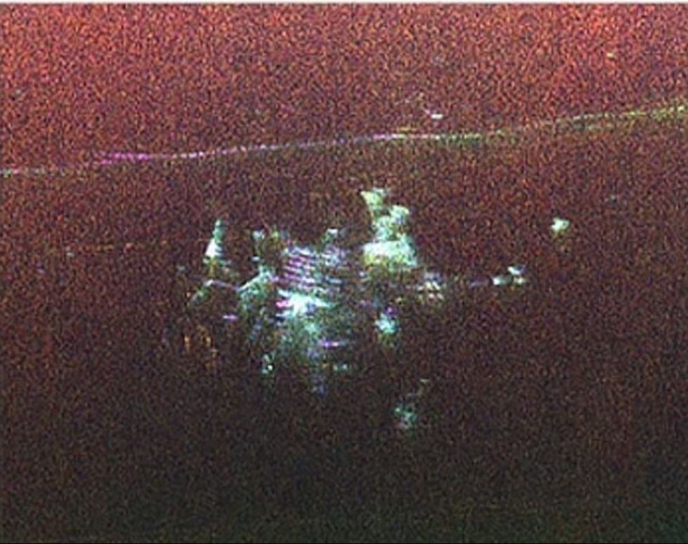
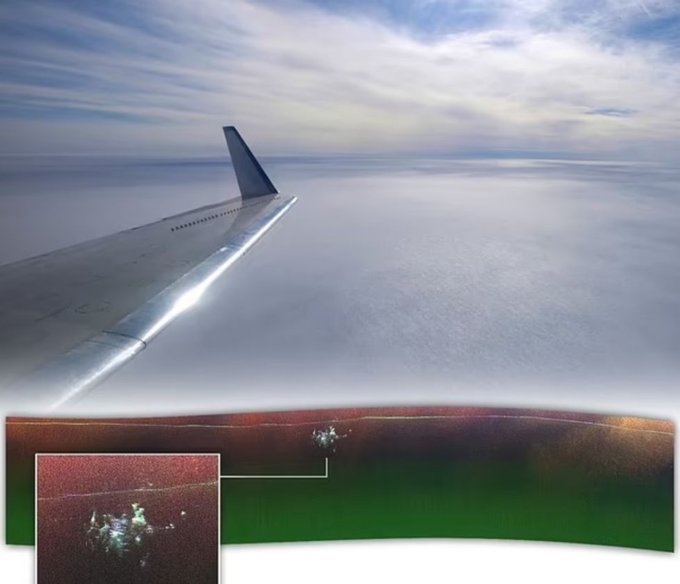
Chad Greene, shkencëtar kriosferik në Laboratorin e Propulsionit (JPL), po fluturonte me një aeroplan mbi akullnajën e madhe kur radari zbuloi papritur diçka të varrosur brenda akullit.
Imazhet e mëparshme me radar të Camp Century nuk dukeshin si asgjë më shumë se një "rrëshqitje akulli", por harta e re zbuloi struktura 3D që përputheshin me dizajnin dhe strukturën e bazës.
Kampi u pa rreth 150 milje në lindje të bazës hapësinore Pituffik në Grenlandën veriore, transmeton Telegrafi.
"Ne ishim duke kërkuar për shtratin e akullit dhe për të dalë Camp Century. Nuk e dinim se çfarë ishte në fillim."", tha kolegu i tij shkencëtar kriosferik i JPL, Alex Gardner, i cili bashkëdrejtoi projektin.
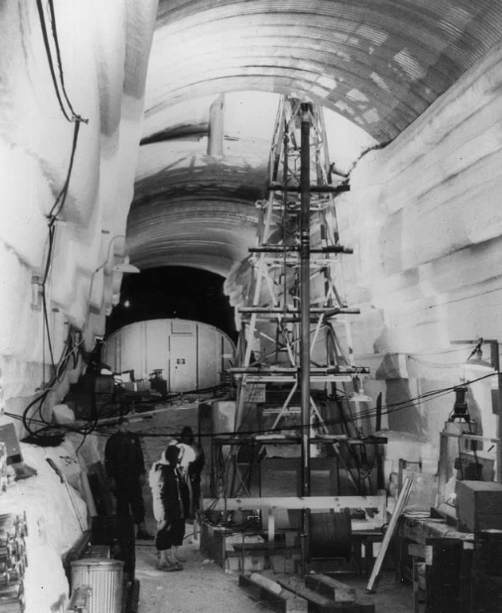
Camp Century, i njohur gjithashtu si 'qyteti nën akull', ishte një bazë ushtarake amerikane e ndërtuar në vitin 1959.
Ajo përbëhet nga 21 tunele të shpuara pak nën sipërfaqen e shtresës së akullit, me një gjatësi totale prej 3 mijë metrash.
U përdor si një front për Projektin Iceworm, i cili synonte të instalonte një rrjet të gjerë të vendeve të lëshimit të raketave bërthamore që mund të synonin Bashkimin Sovjetik.
Por për shkak të paqëndrueshmërisë së shtresës së akullit, projekti - dhe Camp Century - u braktis përfundimisht në 1967, duke u varrosur gradualisht në borë dhe akull.
Kur u ndërtua, Camp Century u publikua si një demonstrim për objekte ushtarake të përballueshme me akull dhe një bazë për kërkime shkencore.
Ushtria amerikane zbuloi qëllimin e saj të vërtetë vetëm pasi u braktis, duke informuar qeverinë daneze - e cila administronte Grenlandën - për qëllimin e Projektit Iceworm.
Camp Century ishte një nga objektet e para që furnizohej me energji nga një reaktor bërthamor portativ, i cili furnizonte me energji elektrike dhe ngrohje.
Kur kampi u çaktivizua, reaktori u hoq dhe mbetjet e tij të rrezikshme u varrosën. Infrastruktura e mbetur u la e mbështjellë me shtresa akulli dhe bore.
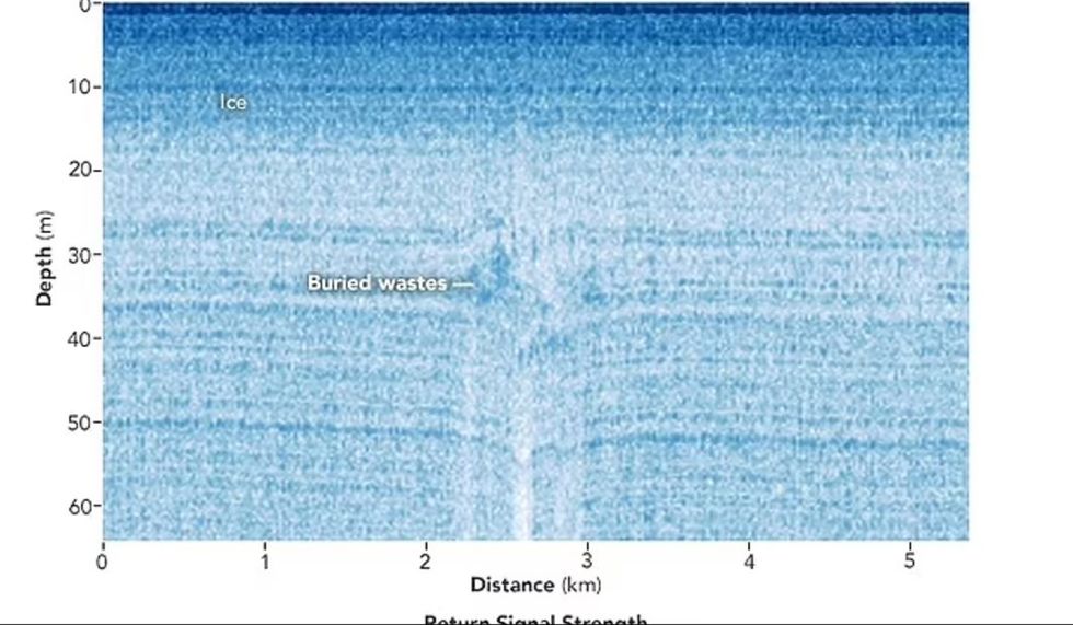
Më parë, shkencëtarët përdorën imazhe konvencionale me radar për të vlerësuar thellësinë e Camp Century.
Kjo punë ofron informacione thelbësore, se kur shkrirja dhe hollimi i shtresës së akullit mund të riekspozojë kampin dhe çdo mbetje biologjike, kimike dhe radioaktive të mbetur që ai përmban.
Imazhi i ri UAVSAR, megjithatë, u kap plotësisht rastësisht.
“Qëllimi ynë ishte të kalibronim, vërtetonim dhe kuptonim aftësitë dhe kufizimet e UAVSAR për hartimin e shtresave të brendshme të fletës së akullit dhe ndërfaqes së shtratit të akullit”, tha Greene.
“Pa njohuri të detajuara të trashësisë së akullit, është e pamundur të dihet se si fletët e akullit do t'i përgjigjen ngrohjes së shpejtë të oqeaneve dhe atmosferës, duke kufizuar në masë të madhe aftësinë tonë për të projektuar normat e rritjes së nivelit të detit”, shtoi Gardner. /Telegrafi/